AIRPORT OPERATIONS
Airport Use: Open to the public
Activation Date: 03/1971
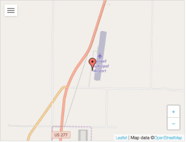
Sectional Chart: DALLAS-FT WORTH
Control Tower: no
ARTCC: FORT WORTH CENTER
FSS: FORT WORTH FLIGHT SERVICE STATION [817-541-3474]
NOTAMs Facility: FTW (NOTAM-D service available)
Attendance: UNATNDD
Wind Indicator: lighted
Segmented Circle: yes
Lights: DUSK-DAWN
ACTVT MIRL RWY 18/36 – 122.8.
Beacon: white-green (lighted land airport)
AIRPORT SERVICES
Fuel Available: 100LL
FOR FUEL WKDAYS 0800-1700 CALL 940-864-2355; NIGHTS & WKENDS CALL 940-864-2345.
Parking: hangars and tiedowns
Bottled Oxygen: NONE
Bulk Oxygen: NONE
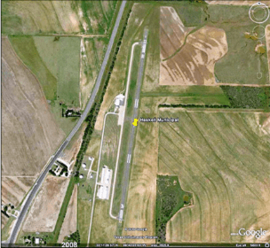
RUNWAY 18
Latitude: 33-11.768548N
Longitude: 099-43.026797W
Elevation: 1589.3 ft.
Gradient: 1.0%
Traffic Pattern: Left
Runway Heading: 180 magnetic, 188 true
Displaced Threshold: 206 ft.
Markings: nonprecision, in fair condition
Touchdown Point: Yes, No Lights
Obstructions: 40 ft. pline, 1000 ft from runway, 370 ft right of centerline, 20:1 slope to clear APCH Ratio 30:1 to DSPLCD THLD.
RUNWAY 36
Latitude: 33-11.209875N
Longitude: 099-43.117915W
Elevation: 1625.4 ft.
Gradient: 1.0%
Traffic Pattern: Left
Runway Heading: 000 magnetic, 008 true
Displaced Threshold: no
Markings: nonprecision, in fair condition
Touchdown Point: Yes, No Lights
Obstructions: 15 ft. road, 416 ft. from runway, 14:1 slope to clear 4 ft pip 174 ft from end 49 ft left of extended center line
